


FISH HATCHERY Voting District, Natrona County, Wyoming
About
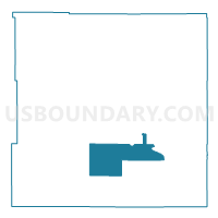
Outline

Summary
| Unique Area Identifier | 698771 |
| Name | FISH HATCHERY Voting District |
| County | Natrona County |
| State | Wyoming |
| Area (square miles) | 230.98 |
| Land Area (square miles) | 230.12 |
| Water Area (square miles) | 0.86 |
| % of Land Area | 99.63 |
| % of Water Area | 0.37 |
| Latitude of the Internal Point | 42.70536180 |
| Longtitude of the Internal Point | -106.73548610 |
Maps


Graphs
Select a template below for downloading or customizing gragh for FISH HATCHERY Voting District, Natrona County, Wyoming


Neighbors
Neighoring Voting District (by Name) Neighboring Voting District on the Map
- ALCOVA Voting District, Natrona County, WY
- NATIONAL GUARD ARMORY Voting District, Natrona County, WY
- OREGON TRAIL SCHOOL Voting District, Natrona County, WY
- POISON SPIDER SCHOOL Voting District, Natrona County, WY
- RED CREEK SCHOOL Voting District, Natrona County, WY
- ST STEPHENS CHURCH Voting District, Natrona County, WY
- VISTA WEST CHURCH Voting District, Natrona County, WY
Top 10 Neighboring County Subdivision (by Population) Neighboring County Subdivision on the Map
Top 10 Neighboring Place (by Population) Neighboring Place on the Map
Top 10 Neighboring Unified School District (by Population) Neighboring Unified School District on the Map
Top 10 Neighboring State Legislative District Lower Chamber (by Population) Neighboring State Legislative District Lower Chamber on the Map
- State House District 35, WY (11,445)
- State House District 58, WY (10,860)
- State House District 38, WY (9,702)
- State House District 37, WY (8,455)
Top 10 Neighboring State Legislative District Upper Chamber (by Population) Neighboring State Legislative District Upper Chamber on the Map
- State Senate District 30, WY (20,562)
- State Senate District 27, WY (20,320)
- State Senate District 29, WY (16,705)